Land for sale, 101252 m²
Retford, Nottinghamshire
231.084 €
Listed Apr 19, 2026
About this listing
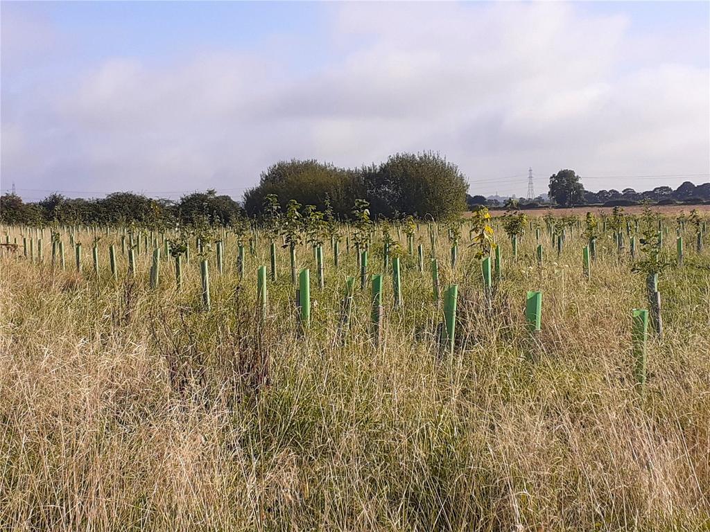
An exciting opportunity to purchase 25.02 acres (10.13 hectares) of recently established woodland, situated close to the village of Cottam in the county of Nottinghamshire. Situation May’s Wood lies to the north west of the village of Cottam, approximately 7.7 miles east of the historic market town of Retford in the county of Nottinghamshire. Description The land extends to 25.02 acres (10.13 hectares) or thereabouts and comprises a single, L-shaped parcel of recently established woodland (previously in arable cultivation). Planted in 2021 under English Woodland Creation Offer (EWCO), the trees are native broadleaved species comprising oak, cherry, willow, sycamore and birch. All trees have guards and stakes. Access is taken from the north off Broad Lane. The land is classified as Grade 3 on the Agricultural Land Classification maps, the Soil Survey of England and Wales indicates that the soils are of the ‘Blackwood’ series, which are described as deep permeable sandy and coarse loam soils. Method of Sale The land is offered for sale as a whole by private treaty. Tenure & Tenancies The land is offered for sale as a whole by private treaty. Services Prospective Purchasers must satisfy themselves as to the availability of services and any future connections. Woodland Creation and Maintenance (WCM) The woodland is now in the maintenance period and the Purchaser will be entitled to an annual payment of £350 per hectare per annum to maintain the new woodland for a further 9 years. Nitrate Vulnerable Zone (NVZ) The Property lies within a Surface Water NVZ Area and is subject to the usual restrictions. Public Rights of Way, Wayleaves, Easements The land is sold subject to or with the benefit of all wayleaves, easements, quasi-easements, rights of way, covenants and restrictions whether defined in these particulars or not. Sporting & Timber Rights Sporting and timber rights in so far as they are owned are included within the sale. Mineral Rights Mineral rights in so far as they are owned are included within the sale. Carbon Units The carbon units are excluded from the sale having already been sold using the Woodland Carbon Code (WCC). Further details available from selling agents. Restrictive Covenants The woodland must remain a woodland and cannot be returned to agricultural production. Solar There are a number of solar projects proposed in the area and part of the land may be a required for a cable easement. Further details from the selling agent. Boundaries Prospective Purchasers will have to satisfy themselves as to the ownership of boundaries. VAT Should any part of the sale or property become chargeable for the purpose of VAT, then such tax will be payable by the Purchaser(s). Local Authority Bassetlaw District Council Plans, Areas & Measurements The plans within these particulars are based on Ordnance Survey data and provided for reference only. They are believed to be correct but accuracy is not guaranteed. The purchaser shall be deemed to have full knowledge of all boundaries and the extent of ownership. Neither the vendor nor the vendor's agents will be responsible for defining the boundaries or the ownership thereof. Health & Safety For your own personal safety, we ask that you to take great care and be as vigilant as possible when making an inspection. Viewings Unaccompanied viewing of the land to be conducted on foot during daylight hours only and when in possession of these particulars. We would request that you contact Fisher German prior viewing. Directions Postcode – DN22 DEU what3words/// recur.brief.funds From Retford, head east out of the town on Leverton Road towards Leverton. Continue on this road for approximately 4.7 miles, then turn right, following the signs for South Leverton. Follow for 0.7 miles and the junction, turn right on to Church Street then take the first left on to Town Street. Travel along the road for around 1.6 miles then turn left on to Broad Lane, crossing the railway and follow for 0.3 miles whereby the land will be on the right.
Plot Area101 252 m² (10.13 ha)
Price per m²2 €/m²
Location
Map loading soon
Neighborhood data on demand
Nearby essentials will load when this section comes into view.
Mortgage calculator
Estimated monthly payment
1.144 €/mo
Down payment10 % · 23.108 €
23.108 €207.976 € loan
Term
Total repayable343.268 €
Interest rate4.40 %
Representative estimate · Landomo is not a mortgage broker. · Rates updated April 2026